Increased travel burdens and longer distances between Palestinian communities
The occupation pushes forward with construction projects and an employment and trade zone in "E1"
Follow Al Rai

Settlement activity threatens to separate the north of Ramallah from its south
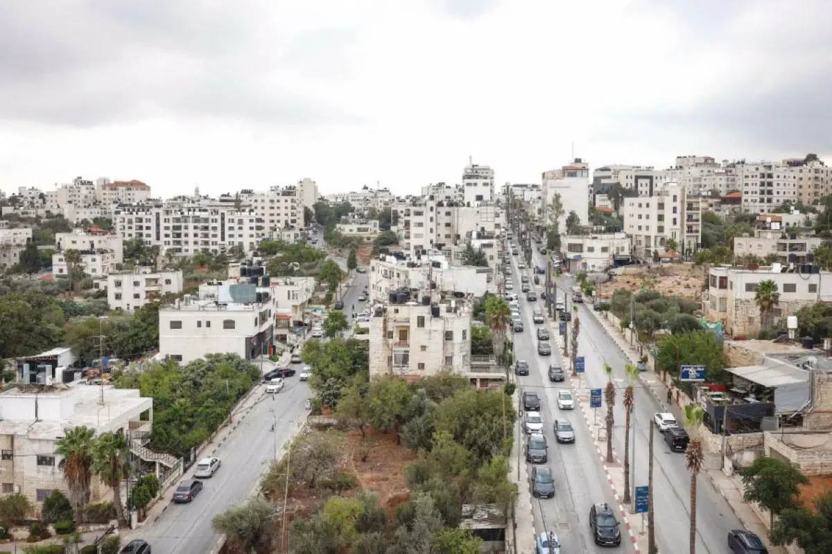
Increased travel burdens and longer distances between Palestinian communities
The occupation pushes forward with construction projects and an employment and trade zone in "E1"
In the heart of Ramallah, just meters away from a consultant hospital, a university, and a sewage treatment plant, preparations are underway to open a highway for settler traffic, a move that Israeli reports say comes as part of broader shifts that are reshaping Palestinian geography and imposing facts on the ground that are difficult to reverse.
The Israeli newspaper "Haaretz" revealed, based on what was published by the right-wing religious newspaper "Olam Katan," that the Israeli army intends to prepare the conditions to open Road 463 to settler traffic.
The road extends for about ten kilometers between Al-Bireh and the Jalazone refugee camp in the east and Ein Qiniya in the west, and it is part of the "Chinese Roads" network established by the Ramallah Municipality to alleviate congestion in the cities of Ramallah and Al-Bireh.
The road was paved in 1994 to connect the settlements of Beit El and Dolev, and is known as the "Fellerstein Axis," named after Pinchas Fellerstein, the then-head of the Binyamin Regional Council, who initiated the paving of settlement roads after the signing of the Oslo Accords with the aim of reducing the areas that were supposed to be returned to the Palestinian Authority.
Haaretz quoted Yisrael Gantz, head of the "Yesha" Council and head of the Binyamin Settlements Council, as saying that "a principled decision to open the road has already been made, the budget is available, and the army has begun security and legal preparations to implement it."
After five days of delay, an Israeli army spokesperson confirmed to the newspaper that the army is "working to create exceptional security conditions for the travel of Israelis on this road in the future."
The danger of the move stems from the road's location and its Palestinian uses, as it serves vital facilities, including the consultant hospital, the Arab American University, and the sewage treatment plant.
According to Haaretz, opening it to settlers will require the establishment of new military points and checkpoints, and possibly the seizure of land along it, which could lead to the separation of eight villages and two large neighborhoods in the northern Ramallah metropolitan area from the areas located south of the road.
This would force tens of thousands of Palestinians to use the old Road 60 near the Jalazone refugee camp, a road that already suffers from severe congestion, thereby increasing travel burdens and lengthening distances between Palestinian communities.
The move, according to the data reported by Haaretz, does not appear to be separate from other moves to control land and roads in the Ramallah area.
On a longitudinal street branching off from Road 463 and extending south to the Al-Tira neighborhood, there is a plot of land that settlers have been visiting for years accompanied by soldiers.
Recently, the land was leveled, concrete blocks were placed, an iron gate was installed, and the Israeli flag was raised on it.
Settlers of the Talmon bloc are also demanding to be allowed to use a road located south of the greater Ramallah area, which was originally paved as compensation for closing Highway 443 to Palestinians.
These moves come in a broader context documented by the Israeli organization "Peace Now" in its report titled "Annus Mirabilis," which concluded that the Israeli government has "annexed large parts of the occupied West Bank at an unprecedented pace" during the period between 2023 and 2025, with a central role for settlers in this process.
According to the report, broad governing powers have shifted from the Israeli army to a civil administration headed by Finance Minister Bezalel Smotrich, who has repeatedly called for imposing Israeli sovereignty over the West Bank. This administrative shift, according to "Peace Now," has contributed to advancing plans to build 40,064 settlement units, capable of accommodating between 160,000 and 200,000 additional settlers.
The report also documented the establishment of 185 new settlement outposts since the current government took office, and 102 new settlements by legalizing outposts or granting neighborhoods independent settlement status, in addition to declaring 25,959 dunams as state land.
It pointed out that settlement farm outposts have seized more than 1.1 million dunams, including about 750,000 dunams during the current government's term.
Amer Daoud, Director of Publishing and Documentation at the Wall and Settlement Resistance Commission, said that the findings of "Peace Now" "confirm what Palestinian institutions have been documenting on the ground for years," adding that Israel is "steadily transforming its occupation into a system of permanent territorial control across the occupied West Bank."
One of the most prominent findings of the report is the spread of settlement outposts in Area "B," which the 1995 Oslo II Accords stipulated would be under Palestinian civil authority.
The report documented the establishment of 21 new settlement outposts in Area "B" over two and a half years, a move it considered an indicator of the expansion of settlement activity into areas that were not under direct Israeli civil control.
In parallel, settlement construction plans are advancing in the E1 area, located between Jerusalem and the Ma'ale Adumim settlement, where the Israeli Ministry of Construction and Housing has announced new dates for issuing tenders for the construction of 3,401 settlement units.
According to the Israeli organization "Ir Amim," the tenders include 1,234 units published in August 2026, in addition to 2,167 other units for which the submission of bids is scheduled to open on October 25, 2026, two days before the Israeli elections scheduled for October 27.
Ir Amim said that pushing forward with construction projects and the employment and trade zone in E1 "will strengthen Israeli geographical continuity between Ma'ale Adumim and Jerusalem," and in return "will lead to further fragmentation of the Palestinian space."
The E1 area covers about 12 square kilometers and is considered one of the most sensitive areas in the West Bank regarding geographical contiguity between its north and south. The Applied Research Institute – Jerusalem (ARIJ) believes that the project does not represent just additional settlement expansion, but a reshaping of the demographic and geographical map of the West Bank, while it is widely viewed as one of the most prominent projects that could affect the possibility of establishing a geographically contiguous Palestinian state.
When presenting the project last year, Smotrich clearly expressed its political goal, saying: "The Palestinian state is being erased, not with slogans, but with actions," and called on Prime Minister Benjamin Netanyahu to complete the step by imposing Israeli sovereignty over the West Bank.
In a press interview, Israeli writer, activist, and former Knesset member Ksenia Svetlova said that the impact of construction in E1 "is not limited to Palestinians, but also affects Israel," considering that the move undermines the possibility of reaching a future settlement based on a two-state solution.
Data contained in Israeli and Palestinian reports indicate that what is happening in the Ramallah area is not an isolated case, as road and construction projects and land seizures coincide with the expansion of settlement outposts and changes in the arrangements of administration and control over increasing parts of the West Bank.
As Haaretz indicated, settlers have shown over decades an ability to plan and act, while the response to their demands is accompanied by the spread of settlement outposts and rising violence, contributing to the further fragmentation of the Palestinian space and turning it into separate enclaves, where movement between them becomes longer and more complex.
Between Road 463, which threatens to separate the north of Ramallah from its south, the E1 project located in a strategic area between Jerusalem and Ma'ale Adumim, and the spread of settlement outposts in Area "B," road and construction projects and changing patterns of land control overlap in a single path that is redrawing geography on the ground, amidst the continuation of the war and the declining ability to reverse the facts being established on the ground.
Know more about this story?Send us a tip
Ask about this report — answers stay grounded in its text.