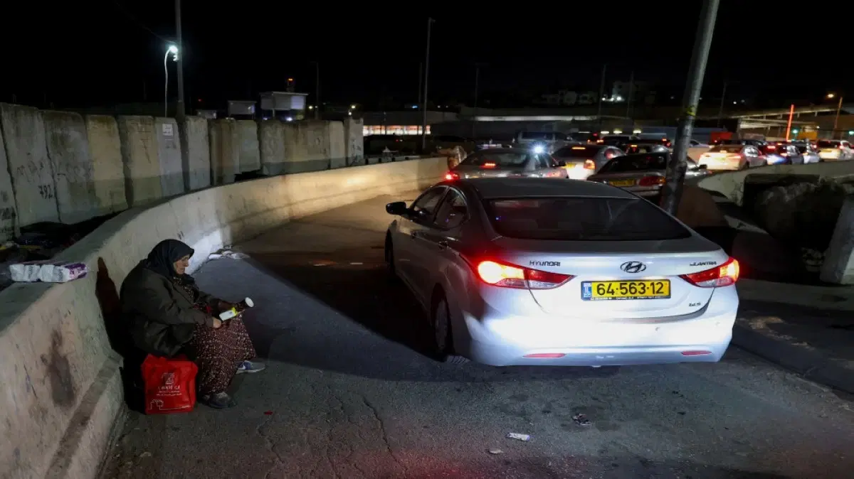
Iron gates have closed the entrances to the eastern villages of Jenin Governorate, checkpoints have cut off roads, and streets have been closed or placed under military surveillance, while bypass roads have lengthened distances and increased the cost of travel.
Conversely, new roads have been paved to serve settlements and military camps, and colonial infrastructure has extended into areas that, years ago, were part of the vital space for Palestinian villages and towns.
In the village of Faqqua, reaching Jenin is no longer just a short trip to the city center; the road today may pass through Deir Abu Da'if, Umm at-Tut, Jalqamus, the Arab American University, Zababdeh, and Qabatiya, and it may stop completely when gates are closed or occupation forces deploy on the streets.
Most importantly, the change has not only affected the roads; the land that a farmer could easily reach is now behind a gate or inside a closed military zone, the settlement that was once far away is now surrounded by a road, a camp, and infrastructure, and the village that was connected to the city by a direct road now relies on bypass routes.
Here begins the story of three years that changed the geography of the West Bank; not because cities and villages moved from their locations, but because the paths that connect Palestinians to each other, to their lands, their services, and their businesses, have changed due to rapid measures.
From Faqqua, east of Jenin, this transformation can be seen in the details of daily life: a journey that has become longer, land that has become more distant, an olive season that has become fraught with risks, and villages whose entrances are controlled by gates that can be opened or closed at any moment.
But what appears in Faqqua as a road closure appears in the rest of Jenin Governorate as part of a larger picture: a network of gates, checkpoints, and military roads, coinciding with land seizure, bulldozing, uprooting of trees, the establishment of military camps and settlements, and the revival of settlements evacuated in 2005.
From Jenin, the picture expands to the entire West Bank, where these measures intersect with colonial expansion, demolition, land seizure, and attacks on farmers, reshaping the geography in which Palestinians move and live.
Faqqua.. A road whose time has doubled and land that has been stolen
The head of the village council in Faqqua, Barakat al-Omari, says that the village, which has a population of nearly 5,000, is located in the vicinity of clusters and towns east of Jenin with a total population of nearly 30,000, and that the occupation's measures since October 7, 2023, have significantly changed the details of daily life.
According to al-Omari, the direct road between Faqqua and Jenin used to take, under normal circumstances, about 10 to 12 minutes, while today the trip takes between 45 minutes and an hour, especially when roads or gates are closed.
He says the alternative route passes through Deir Abu Da'if, Umm at-Tut, Jalqamus, the Arab American University, Zababdeh, and Qabatiya before reaching the city of Jenin.
The problem is not limited to the increase in travel time; the increased distance means higher transportation costs, as the cost of travel has risen in some cases from about 7 or 7.5 shekels to about 15 shekels, according to al-Omari.
He points out that closures occur continuously, sometimes once or twice a week, while some closures are linked to the movements of settlers or events held in the settlements.
Al-Omari says: "The area has changed 180 degrees," noting that the change has affected the economic, security, social, and psychological situation of the citizens.
In Faqqua, the problem is no longer just the road to the city, but also the road to the land.
Al-Omari points out that the occupation army's orders prohibit approaching the area of the Annexation and Expansion Wall for a distance that extends, in some areas, between 200 and 500 meters, along about 5,000 meters of the village's land.
According to his estimates, the areas that have become difficult or impossible to reach range between about 3,500 and 4,000 dunams, out of about 8,500 dunams which is the area of Faqqua's land.
These lands include agricultural areas, pastures, and olive groves, while the inability to access them for long periods has led to damage to crops and the outbreak of fires in some areas due to the inability to reach them.
Al-Omari adds that settlers have established a new outpost between Faqqua and Arabuna, and seized large areas of land, which he estimates at about 2,000 dunams, while access to these lands has become impossible even for their owners.
The occupation also issued orders to seize about 750 dunams of Faqqua's land in the Jabal Abu Qais area between Arabuna and Faqqua, and objections and legal files have been submitted regarding them.
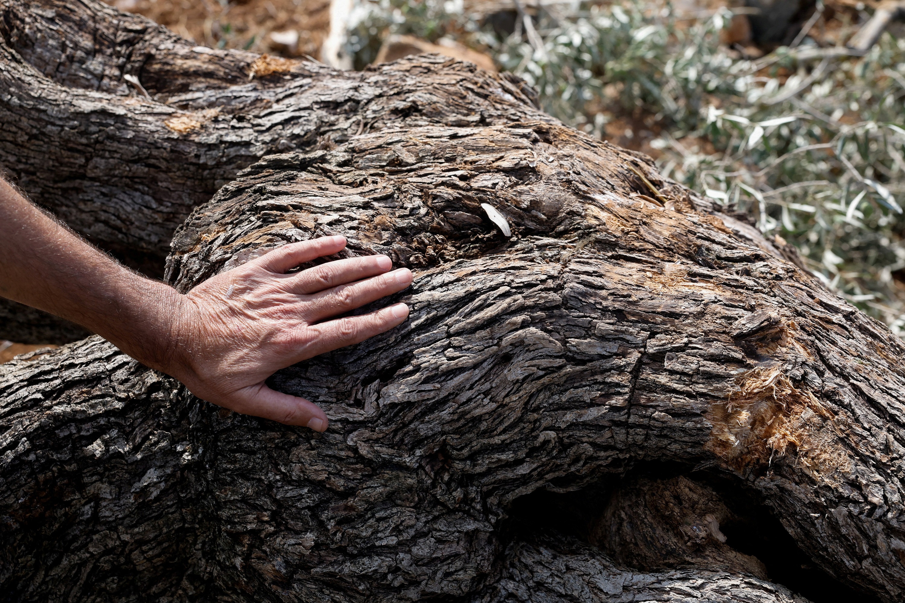 A Palestinian touches an olive tree uprooted by Israeli military machinery near the village of Deir Nizam near Ramallah. Occupied West Bank. September 23, 2026. (Reuters)
With the olive season, the problem has become more apparent; citizens have not been able to reach all their lands, while olive fruits have been stolen by settlers in several lands, including lands officially registered in the names of their owners.
Al-Omari warns that the continuation of these measures may lead to the isolation of the villages east of Jenin from the city and from each other, especially in light of the presence of about ten gates and closures at the entrances to villages and roads in the area.
The danger is increasing for health services, as there is no hospital or large health center in eastern Jenin, while citizens are demanding the operation of an emergency health center that was built through local efforts.
Jenin.. Land, road, and camp
What is happening in Faqqua is a microcosm of a larger transformation in Jenin, as described by the official in charge of the settlement file in Jenin Governorate, Tariq Ighbaria, who confirms that what is happening represents an "unprecedented field and geographical transformation," noting the occupation's shift from the pattern of raids and temporary patrols to the establishment of a permanent military and colonial infrastructure.
According to a report prepared by Ighbaria, the measures included the seizure of land, the establishment of military camps, the paving of military roads, the establishment of new outposts and settlements, and the reactivation of settlement sites that were evacuated in 2005.
Among the most prominent seizure orders: the seizure of 7.247 dunams in the Jabriyat neighborhood inside Area "A", and 128.631 dunams of Arraba land to establish a military camp, in addition to 2.8023 dunams in Jaba' to establish a military checkpoint on the Nablus road.
516 dunams were also seized to pave a road connecting Sanur (Tarsala) to Homesh, and about 22.806 dunams near the Qabatiya basin and the Haddad tourist village area to be used for establishing a military camp.
Ighbaria also points to the occupation authorities' seizure of more than 300 dunams west of Ya'bad in the Saruj area, for purposes related to an industrial zone, an outpost, and a road leading to the Annexation and Expansion Wall, which was accompanied by the uprooting of hundreds of olive trees.
Orders were also issued to seize 22.026 dunams in Ya'bad, while on July 28, 15 military seizure orders were issued for about 200 dunams in the areas of Qabatiya, Arraba, Marka, and Masliya, including lands inside Area "A".
In Arraba, Qabatiya, and Masliya, about 177 dunams were also allocated for a military road connecting the Arraba camp, established near Mevo Dotan, to the new settlement "Noa" established on the lands of Qabatiya.
Settlements redraw the road network
The reshaping of geography does not stop at the establishment of gates and checkpoints, but includes the creation of new roads to serve settlements and military camps.
In Jenin Governorate, Ighbaria points to the establishment of settlements or plans for new settlements, including "Emek Dotan" near Arraba, "Rom Gilboa" near al-Mughayyir, "Ma'ayanot" near Arabuna and Faqqua, "Noa" in Qabatiya, "East Sanur" near Tarsala, "Taanach" near Taanakh and Silat al-Harithiya, "Alon Shvut" near Khirbet al-Khaljan west of Jenin, and "Har Bezek" near Rummana.
At the same time, the occupation has revived settlements evacuated in 2005, including "Kadim" east of Jenin, "Sanur/Tarsala", "Homesh" on the lands of Jenin and Nablus, and "Ganim" east of the governorate.
On September 22, Ighbaria noted the installation of ten iron gates at the entrances to the towns and villages of eastern Jenin, and the closure of roads leading to the bypass road extending from Al-Jalama towards Zababdeh and the Arab American University, which affects the movement of more than 30,000 Palestinians.
On the 23rd of the same month, the placement of concrete blocks continued on the eastern bypass road of the city of Jenin, which led to the separation of the area from the city and complicated the access of students to the Arab American University, in addition to its impact on commercial and economic movement.
Last August, the occupation forces closed roads leading to the bypass road that connects 'Aba to Al-Zababdeh, following the demolition of dozens of commercial and economic facilities in 'Aba, which affected access to the city, hospitals, and universities.
Thus, the road, which was originally a means of connecting villages and the city, is transformed into a tool for controlling movement.
Along the road connecting 'Ajja in the south to Arraba and Ya'bad, occupation bulldozers carried out leveling and uprooting of olive trees on both sides of the road, under the protection of occupation forces. The operations included both young and ancient trees, affecting more than 310 dunums.
The head of the Wadi Da'uq council, Abd al-Nasir Hussein al-Huwaiti, says that the damage affected dozens of dunums, and that some of the uprooted trees ranged in age from 15 to 30 years, while some were nearly 35 years old.
As for 33-year-old Abdullah Abu Ali, he says the damage affected 16 dunums of his family's land, whose trees his father had planted since 1986.
In Arraba, located southwest of Jenin, military and colonial measures are rapidly overlapping.
The mayor of Arraba, Ahmed al-Ardah, points out that nearly 1,500 dunums near "Mevo Dotan" have become inaccessible to their owners since the beginning of the war, while other measures have affected nearly 1,400 dunums near "Emek Dotan".
According to al-Ardah, the occupation forces carried out leveling and uprooting operations on an area of 223 dunums in the Arraba area, coinciding with the establishment of the "Emek Dotan" site, the introduction of families into it, and the construction of infrastructure and roads.
In Qabatiya, seizure measures are no longer limited to areas classified as "Area C"; the governorate has recorded orders affecting lands within "Area A", including an order concerning nearly 7.498 dunums in Qabatiya opposite the new colony "Na'a", to be used as a military site.
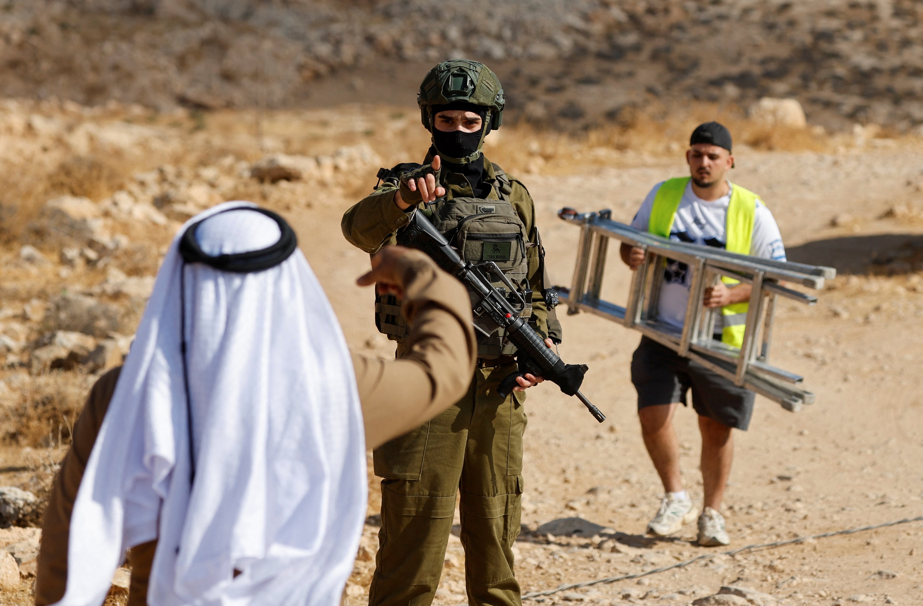 An Israeli occupation soldier gestures to move an elderly Palestinian man away during the demolition of a building near Hebron in the West Bank. October 5, 2026. (Reuters)
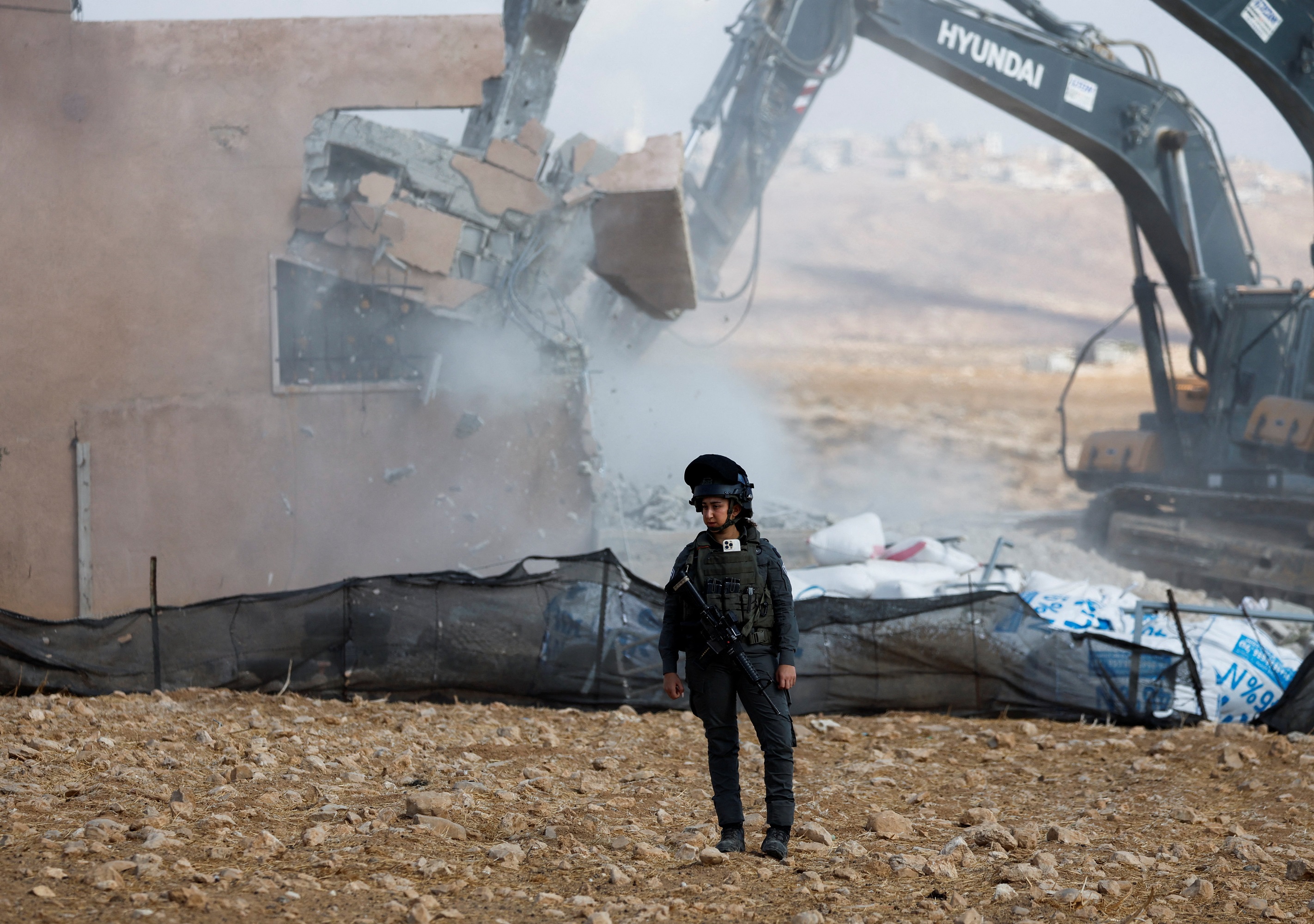 A member of the Israeli occupation forces stands during the demolition of a building near Hebron in the occupied West Bank. October 5, 2026. (Reuters)
Demolition Operations
In addition to roads and land, demolition operations have changed the appearance of a number of towns and villages.
Ighbaria points to the issuance of 105 demolition notices against residential buildings in various areas of Jenin Governorate, in addition to commercial, agricultural, and economic facilities.
Also, 28 residential buildings were demolished in Barta'a, which housed more than 130 people, and a commercial building in Arraba with an area of nearly 320 square meters was demolished, in addition to buildings in 'Anza, Arraba, and other areas.
In 'Aba, dozens of commercial and agricultural facilities were demolished during August and September, while notices affected horse and sheep barns, greenhouses, and agricultural facilities.
Thus, the geographical change is not limited to roads and open spaces, but reaches the urban fabric itself, by removing existing buildings and preventing Palestinian urban expansion, in conjunction with the expansion of colonial and military infrastructure.
From Jenin to the West Bank
What is happening in Jenin is not an isolated case; according to a report by the Wall and Settlement Resistance Commission issued on October 4, the West Bank, including Jerusalem, has recorded 62,916 attacks since October 7, 2023, including 48,174 attacks carried out by occupation forces and 14,742 carried out by settlers.
The report recorded the martyrdom of 66 Palestinians in settler attacks, 1,182 fires, in addition to damage to 147,111 trees, including 100,485 olive trees. Jenin Governorate had a share of 23,658 damaged trees.
The report also monitored 922 land leveling incidents, 2,645 attacks on trees and crops, and 211 attempts to establish new colonial outposts, while at least 376 Palestinian villages, towns, and communities were subjected to settler attacks.
In the field of demolition, the report recorded 1,814 demolition operations that affected 5,059 facilities, including 1,894 inhabited houses, 1,524 agricultural facilities, and 723 facilities related to livelihoods.
It also monitored 2,133 demolition or work-stoppage notices, 7,775 attacks on property, 1,120 seizure operations, and 1,437 theft incidents.
Reshaping geography is not limited to direct seizure of land; there are multiple tools that lead to the same result: preventing access, declaring military zones, building roads, seizing control, declaring state land, or establishing military and colonial infrastructure.
According to the Wall and Settlement Resistance Commission, nearly 64.2 thousand dunums of West Bank land have been subjected to various mechanisms of seizure or control.
The commission recorded 231 military seizure orders or measures on land affecting nearly 5,268 dunums, including 46 orders to establish buffer zones around settlements, and 122 orders related to security and military roads.
Also, nearly 29.7 thousand dunums were declared as "state land", and 11 official acquisition operations were carried out, affecting nearly 3,534 dunums.
Colonial Planning Precedes the Road
In parallel with controlling the land, the settlement planning process is advancing.
Data from the Wall and Settlement Resistance Commission indicates the submission of 89 plans in the West Bank, including 19,221 colonial units on an area exceeding 23 thousand dunums, in addition to the approval of 148 plans including 24,913 units on an area of more than 29 thousand dunums.
The occupation authorities have also issued 97 tenders since the start of the war to build 15,760 colonial units, including 84 tenders in the West Bank including 12,872 units, and 13 tenders within the Jerusalem municipal boundaries including 2,888 units.
In the "E1" area alone, the planning includes nearly 3,401 settlement units.
This means that the road that appears today as a new or bypass route is not necessarily an isolated measure; in many cases, it comes within a broader system that combines land, planning, road, colony, and military camp.
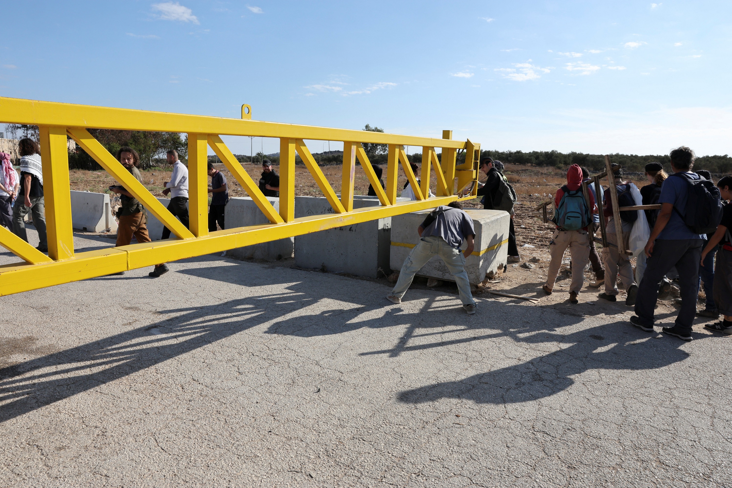 Foreign and Palestinian activists cross a gate leading to the village of Rantis during the harvest season in Palestinian olive groves near Ramallah. Occupied West Bank. October 6, 2026. (Reuters)
Checkpoints.. A Network Reshaping the West Bank
Data from the Wall and Settlement Resistance Commission, updated as of September 25, 2026, reveals that the system of checkpoints and closures in the West Bank has turned into a vast spatial structure that reshapes the movement of Palestinians and cuts off communication between communities.
According to the commission, the number of checkpoints and obstacles reached 942, including 824 permanent checkpoints and closure points, in addition to 118 linear obstacles such as earth mounds, trenches, and roadblocks, with a total length of nearly 107.7 kilometers.
Hebron leads in the number of permanent checkpoints with 221, followed by Ramallah and Al-Bireh with 160, and Nablus with 120, while Jenin recorded 26 permanent checkpoints and closure points, compared to 16 previously, after adding 10 new gates and checkpoints during the last two months.
The new points in Jenin included locations at Al-Jalama, 'Arrana, the Industrial Zone, Deir Abu Da'if, the entrance to Jenin, 'Aba, Umm al-Tut, Qabatiya, the vicinity of the Arab American University, and the Al-Zababdeh junction.
A temporal comparison shows the expansion of the closure system from 757 obstacles in 2003, to 705 in 2018, 793 in March 2024, then 925 in December 2025, reaching 942 in 2026.
The significance of these numbers lies not only in the number of checkpoints, but in their locations at the entrances to cities, villages, and road junctions, making access to places of work, education, treatment, and agricultural land dependent on the possibility of opening or closing the road at any time.
Three years ago, the question in many West Bank villages was simple: How far is the village from the city?
Today, the question has become more complex: Which road? Is the gate open? Is there a checkpoint? Is the military road closed? Can the land be reached? Does the army allow the farmer to pass?
Thus, within 3 years, the borders of cities and villages on the map have not necessarily changed, but the network of relationships that connected them has changed; the geography of movement, the geography of land, and the geography of access to work, education, health, and markets have changed.
Distance in the West Bank is no longer measured by kilometers alone, but by the number of gates and checkpoints, the probability of road closures, and the ability to access land, cities, and services.
In this sense, the map itself is no longer what it was 3 years ago.